Berliner Register
Map application
The developers from ctrl.alt.coop informed themselves, and adapted themselves to the work of Berliner Register, allowing ideas to be implemented in a practical manner. Technical details were explained in an understandable way, which led to an appreciative and trusting cooperation. We’re happy with the great results!
Jeannine Löffler
Coordinator of the registry for Treptow-Köpenick, Berliner Register
Project goals
The project Berliner Register has been running for several years as a documentation site of incidents categorized as anti-Romani and Sinti, far right, chauvinist, ableist, or anti-feminist. Recorded incidents are publicly visible on their site, to raise awareness of discrimination and exclusion.
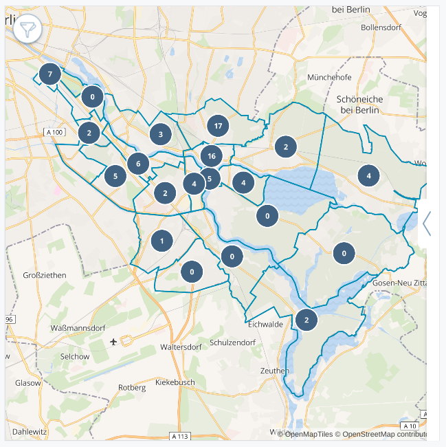
Previously, these incidents were visible in a list form. The goal of this project, which was requested from the registry for Treptow-Köpenick, was to add a map overview, to give an indication of where in the district incidents were taking place.
Design
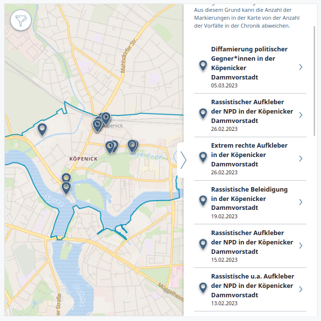
The map application consists of three levels, which can be easily navigated between one another.
- The first and largest level is the district view, showing incidents aggregated by the district localities.
- Clicking on a locality, takes the user to the second view, showing individual incidents within that locality, as well as incidents for which there is no precise location data.
- Clicking on an incident takes the user to the incident view, where the user sees the specific details of that incident.
There is also a simple filter functionality built into the application, so the user can filter incidents for a specific year, incident type, or motive.
Technologies
The project was an extension of a django based web frontend using tailwind and wagtail.
The implementation of the map itself was built with MapLibre , an open source library for rendering interactive maps.


